Hike to Chäserrugg – Hinterrugg
Hiking is one of the best things you can do in Switzerland. The landscapes are absolutely stunning – I never get tired of it! My friend and I wanted to do something relatively accessible from Zürich, but also with spectacular views and a bit of physical challenge. After some iterations, we ended with the idea of going to hike to Chäserrugg-Hinterrugg. And the hike, as always, did not disappoint!
Getting there
Starting point: a great place to start is Alt St. Johann, a small town well-connected with cable car options in the region. There is a small parking lot next to the bus stop Alt St. Johann, Dorf (B790), or if the lot is full, you can park directly next to your return gondola Talstation Sellamatt-Bahn, which is 5 min away from the bus stop by foot. From there, take the bus to the Unterwasser Chäserrugg Bahn, which will take about 5 min and will leave you right next to the cable car. The Unterwasser Bahn has a stop at Iltios, from where you can start the hike.
Distance: the hike has several options in terms of available trails that end up leading to the same places. We ended up walking for 12.8 km, but you can extend the route by not taking the gondola and cable car.
Total time: approx. 5 h
Elevation gain: 864 m
Fitness difficulty: Moderately challenging. The first half of the hike is constantly going up and it gets steep in some places.
Technical difficulty: mostly easy, there were some loose rocks in some places.
Facilities: there is a restaurant and bathrooms on the top. Also, there is a cable car that goes to Iltios.
Finishing point: if you’re ok with walking a bit more, this route can be a loop. However, you can also take the gondola at Sellamatt and descend to Alt St. Johann.
Notes:
- The way down is not recommended if you’re afraid of heights – the slopes are steep, and in one point you need to hold on a rock to continue the hike as there is no path.
- There are several alternative paths that bring you to the same points. Consult with apps such as AllTrail to choose the one you prefer.
- I got some insect bites, so if you concerned about it spray yourself with insecticide.
- The hike is in the mountains, so while the temperature might feel pleasant, the sun is strong. I got sunburned in some areas that I missed when applying sunscreen.
The hike itself
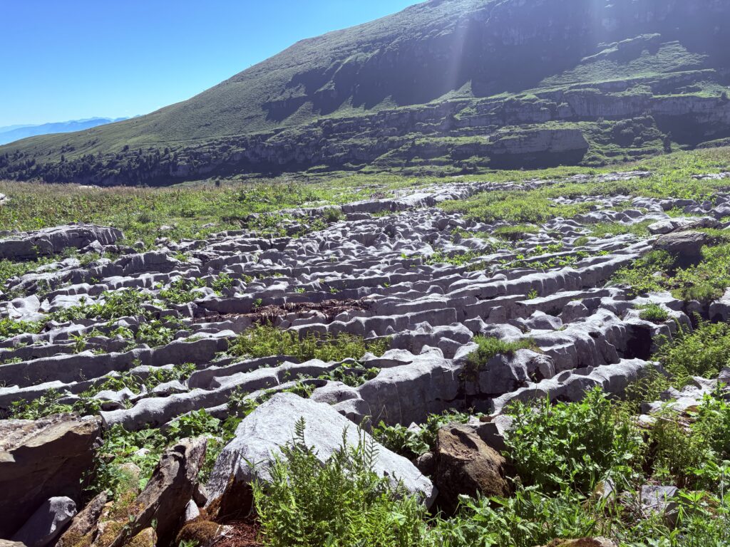
The first half of the hike is constantly going up. It starts in a foresty area, where you pass by many wild flowers and see great views of a valley. After around one third of the height, you will reach a part with interesting rock formations. The path is well-indicated with red-white marks, so there’s no way to get lost.
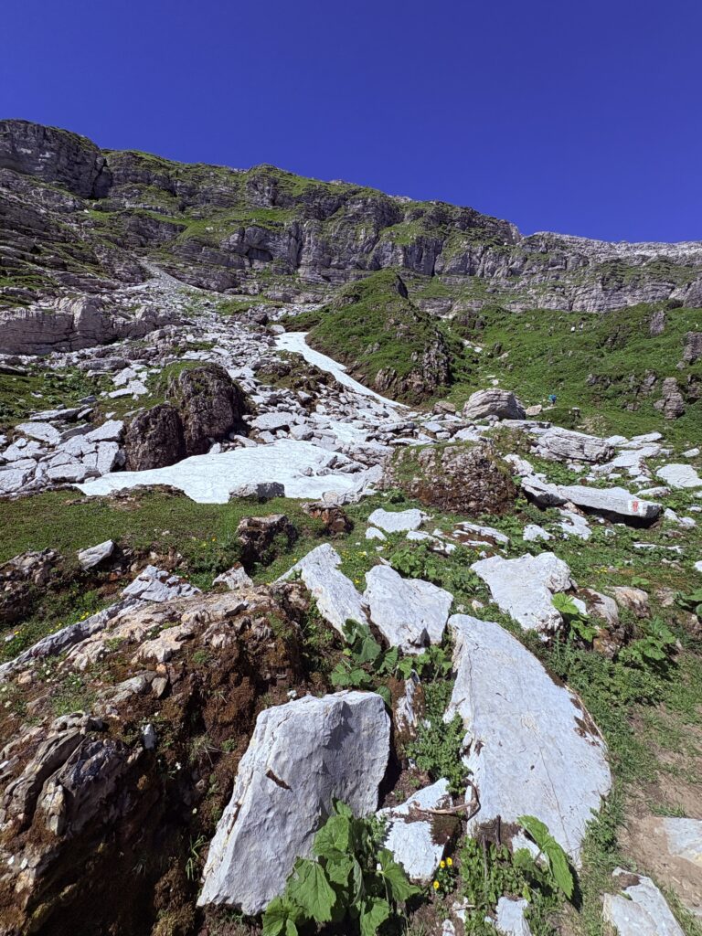
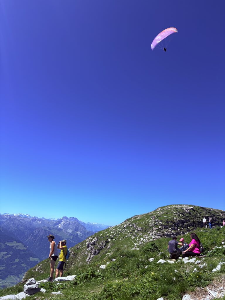
When one third of the height is left, you’ll reach one of the toughest parts of the hike, as the steepness of the mountain considerably increases. Once you climb this area, you’ll have arrived to the cable car area, where many paragliders are starting their journey.
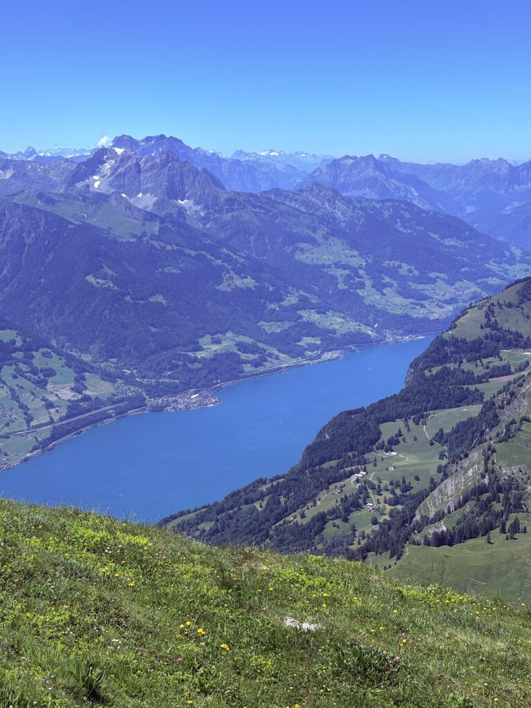
From Chäserrugg you can enjoy the views and it’s also a great spot for a meal. Your next stop will be Hinterrugg, the next mountain. There is a short path going down and up again, which will lead you to an excellent view of the Walensee.
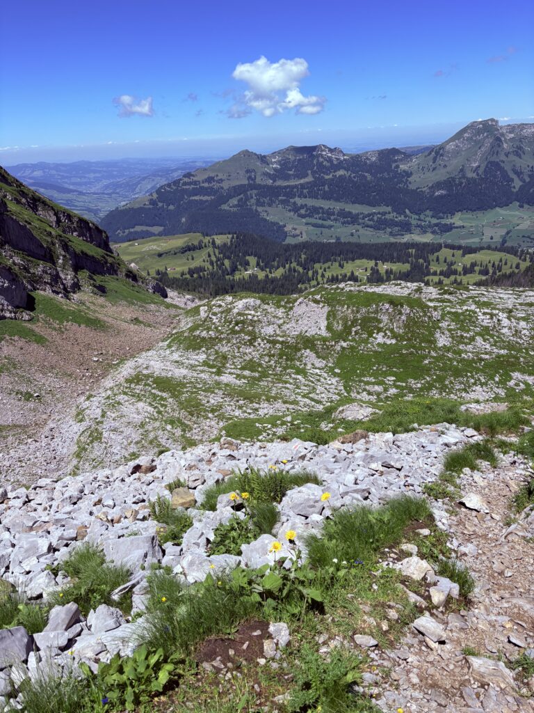
The way down is quite steep. Once again, the landscape becomes more rocky towards the middle part of the hike, with some parts with loose rocks on the way. You will pass several areas that are enclosed, so don’t forget to lock the doors after you! The bottom third has again more forest, and parts of the path have many plants, including nettles, so be careful.
Highlights of the hike
- Beautiful views from Chäserrugg and from Hinterrugg of the Walensee.
- You can see Steinböcke (Alpine Ibex), many birds and wildflowers.
- Chäserrugg is a popular spot for paragliders, so you may see many of them flighing around the mountain.
Need more inspiration?